Jumat, 27 Februari 2015

North Ottawa Dunes

December 12 2011
North Ottawa Dunes,  513 acres, an Ottawa County park. 
For more info on this park check out this link,
(http://www.co.ottawa.mi.us/ParksVI/Parks/dunes.htm)


We parked at the entrance of Ferrysburg’s Coast Guard Park (18161 North Shore Road Ferrysburg Michigan)  here you will find signs marking the North Ottawa Dunes trail.  No bikes, no horses, yes to dogs on a leash and in the control of the owner.  It was a beautiful December day, with blue sky and no snow.


We were out 4 1/2 hours and covered about 4 miles, walking as far as
P.J. Hoffmaster State Park. The property features tremendous topography with an elevation change of 185 feet in the parabolic dune formations. Eight distinct dunes in the rugged landscape exceed 750 feet in height.


   Not wildflowers but nice to look at.


 We even found a Field Pansy blooming!  It was a small flower so I took a photo through Marie's hand lens.

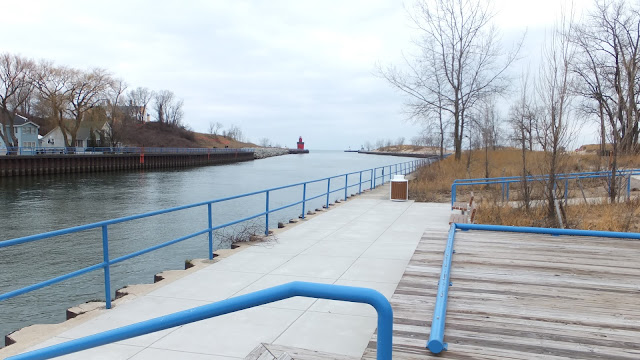
                                   Coast Guard Park from the entrance

Plenty of room to roam.

Rabu, 25 Februari 2015

Big Bend National Park, a trip to Texas - February 2014 (Part one)

Texas here we come...

We have had quite the winter here in Grand Haven Michigan, very cold and tons of snow.  I like the snow but it can warm up now, it is the end of February. 

Mike and I took a break from winter and visited our oldest son, Andy, (and family) in Midland, Texas.  Andy planned a fun trip for us while we visited, this time we went to Big Bend National Park.  This was our second trip to Big Bend, we went there in 2011.

Our first day in Midland, Mike and Andy took the dirt bikes for a ride at an adventure park. They rode around for a couple hours while I stayed with the truck and sought out bugs and plants.  I found a few bugs not many plants, and it was warm.

The next day we drove to Terlingua, Texas where we rented an Airstream motor home from Retro Rents.


The Retro Rents Airstream was fine for a home base, except for the fact that the water supply was not secure and twice flooded the back half of the unit. 

Andy has some property nearby which we visited (mostly when it was dark).  Here are a couple views from the high point of the property looking at the moon rising.

We hiked the next day to Cattail Falls, oh cattails that reminds me of marshy Michigan...


 Along the trail to Cattail Falls...

It was very warm and I think it was at this point my cold Michigan bones thawed, it felt good.


 Cattail Falls had some water trickling down, and there were cattails and a pond.
Rock reflecting in the pond.

I saw several butterflies, and some sort of red trumpet type flower, maybe Scarlet Sage.


    Back to the truck and air-conditioning. 
Just driving along there are mountains, beautiful mountains.  Texas also has a huge sky and it seems to be mostly blue.  Since Andy is a PhD geologist, and is familiar with Big Bend, he tells us interesting information, as we ride along, about the mountains and rocks.  Unfortunately, I remember very little of what he says, but I thoroughly enjoy listening.

We started seeing these flowers alongside the road, Andy pulled over so I could get out and photograph these beautiful wildflowers, Texas Bluebonnets (Lupinus texensis).  Wildflowers!

Next on to Santa Elena Canyon, we did a quick walk here, it was getting dark.  The water level was high in the Rio Grande River.  The rock on the left side of this photo is Mexico.


A pretty mountain in Big Bend National Park, Texas
A nice home in Grand Haven, Michigan. 

 
In case you are not familiar with the location of Big Bend National Park, I circled the approximate area in red on the map below. The park is huge with ~ 801,163 acres!  In the next post, the second half of the trip, including a river rafting trip on the Rio Grande River.


Selasa, 24 Februari 2015

Mount Pisgah Ottawa County

December 17 2012
Mount Pisgah is an Ottawa County park in Park Township, Holland, Michigan. This is very near the Holland State Park.  Here is a link for more information.
http://www.miottawa.org/Parks/beach.htm#pisgah


This is a busy place in the summer but on a cold December day it wasn't crowded.  We parked at Black Lake Boardwalk East, here you will find picnic tables, kayak access to Lake Macatawa, and fishing docks, this is also part of Historic Ottawa Beach Parks, as is Mt. Pisgah. 

You have a short walk back along Ottawa Beach Road to a gazebo with informational signs about Mt. Pisgah which is large sand dune.


From the top of Mount Pisgah on a cold, gray day in December looking at Lake Michigan.

It is 239 steps to the highest landing, with many landings and benches along the way up. It was worth the climb. After we got our fill of the view, we followed a level boardwalk that curved around behind the big dune. This boardwalk was built on the very steep backside of the dune.

This is looking east over Lake Macatawa.

 The boardwalk soon ends but a dirt trail leads you on. There are map signs along the way.  I was surprised that these trails were here.  I thought we would hoof it up the stairs and back down, so this was a pleasant surprise.

 In this shot you can barely see the boardwalk way up on the backside of Mount Pisgah.

After touring the Mt. Pisgah area we headed back to the car.  We went west towards the Holland State Park but first came to Black Lake Boardwalk West.  We found wildflowers blooming, and it was only 33 degrees!  Blooming were Evening Primrose, Hoary Alyssum, Queen Anne's Lace, Spotted Knapweed, a yellow mustard, and Bouncing Bet!     (Plants amaze me!)


After this adventure we went north and decided to stop in at Riley Trails, another Ottawa County park.  But there was work being done here, tree harvesting. 


So not much to say about Riley Trails, most of the trails were closed.  We took a short walk and moved on. 

By visiting Mount Pisgah, my sister Marie and I met a sort of milestone.  We have been to all of the Ottawa County Parks and Open Space Lands listed on their brochure, except for Ripps Bayou and Kuits Bayou which you can only reach by boat.  So that is 36 of the listed parks and places, some of these we have visited multiple times and covered extensively!  More on this next time.

Wau-ke-na William Erby Smith Preserve

2012 02 06  A Southwest Michigan Land Conservancy preserve, Wau-ke-na William Erby Smith Preserve is where we landed. 

We took exit 34 from U.S. 196/ U.S. 31, drove south on Lakeshore Drive past Pier Cove Park, continued south past West Side Park, finally turning west on 121st Avenue.  There is a Ganges Township road end access point here to Lake Michigan.  Plummerville Creek is on the south side of this road.

     121st Avenue Road end
  Plummerville Creek- private land


 I have mentioned before the book, "Michigan's West Coast  Explore the Shore Guide" by Brian Hutchins, it has directions to many "out of the way" road ends that are legal to access.


We have been here before, we didn't get out of the car.  Along this 121st Avenue is a small sign, "State Wildlife Sanctuary" what's that about?

On down the road we went, crossing over Plummerville Creek, then past the Plummerville cemetery, over one more road and we have arrived at Wau-ke-na, north.
We parked in a grassy lot at 9:33am, it was cloudy, gray, and 34 degrees.  This was a day the forecasters kept saying sunny, blue sky - it is almost better when they say gray sky and clouds because they seem to get it wrong more than right.


Anyway off we go on a new adventure.  We had some maps that we got online, some help to know what was here and where we could go.  A grassy two-track was leading us off around big fir trees and through fields.
                 Map, North tract Wau-ke-na
   We also saw signs with the name this way.
                 Rules to follow,  please


Soon we reached the bluff above Lake Michigan, there was a bench and a stiff wind. 

 Bench on the bluff
Looking south over the bluff we could see water flowing across the beach.  That's where we want to go!  But how, we couldn't go down the bluff.

We went south, following the trails - we came to a cut in the bluff so down we go, and there was another sign for Wau-ke-na. The water flowing across the beach seemed to just appear out of nowhere and there were rocks, lots of rocks.

    Creek Ahead

    Maybe not a creek but a seep?


After checking out the rocks we turned south and walked on the beach until we came to another creek!  It was cold and windy, but not unbearable, and definitely better than 90 degrees.
 Second creek on the beach


One of us was looking for certain kinds of rocks, I don't want to give away all our secrets, well we may have found a "Lightning Stone".  Or maybe we didn't.
                             Lightning Stone?
Another book "My Michigan Rocks and Minerals", says these Lightning Stones are brownish-red stones with lightning bolt patterns, it also says they are Septarian Geodes but they are not geodes at all, so a better name is Septarian Nodules.  This is too deep for me, I just thought they looked cool.

We enjoyed the creek immensely.  We found many neat rocks.


Feathered Rock? Nope just a feather

    Got Rocks?

Finally we turned north, headed back up the beach, past by where we had come down to the beach from Wau-ke-na, walked all the way to Plummerville Creek.  Remember this is where the access point is from 121st Avenue. 

   Plummerville Creek

Plummerville Creek was much larger than the other creeks we had seen today.  We weren't sure we could cross it, but just as the water reached the big lake there was a place to cross if we timed it right with the waves.  The current was strong and the sand sometimes collapsed under our boots, yikes!  We made it.

Huge sandstone cliffs!  Oh what's that?  You can see the house on the right of the picture. 

We found some rocks here, and lots of houses.  We walked back to Wau-ke-na.  Up the wide cut and off into the woods we go. 

                                     Moss
                 Liverwort?  Lichen?  I'm still figuring these out.

Great walking here, mostly a forest of firs.  At the car it was 12:40 and still 34 degrees.  So about 3 hours of fun so far.

We drove ~two miles south to Wau-ke-na south tract, wow this is a wordy post, blah blah, anyway... 
Map Wau-ke-na South Tract

There is preserve property on both sides of the road, to the east we didn't go, there is tall planted grass, solid grass. 

          East section of Wau-ke-na South Tract

We walked on west, here there were signs of restoration everywhere, not pretty, but the SWMLC has big plans for the land. 


I'd say there are more ponds and swamps on this tract than the north tract.  We followed along a trail which was mostly flooded, this was in the woods. 

Swamp at Wau-ke-na South Tract

Then came a huge open field on the southern half of the preserve, we went all the way around this field enjoying our day. 
Pond

We wandered around some odd ponds, maybe I was getting tired but I was ready to sit down.  I think I liked the north tract more.  We walked for about an hour, got to the car, and found the temp had dropped two degrees, and still no sun.

We left Wau-ke-na behind and drove around the area a bit then went north through the town of Ganges.  Then home.  We walked over 5 miles today.  No sun but lots of fun!