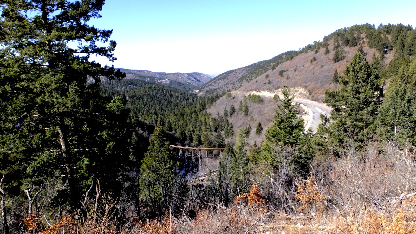
This post is about our last day in Texas, on our February 2013 trip. We have been to nature preserves, hiking in the mountains and canyons, viewing lava flows, and gypsum dunes, going on aerial tram ride, and more. All thanks to our son Andrew's great planning.
We did save the best for last, going for a ride in Andrew's plane with him as the pilot.
What a cute little plane. The guys did some maintenance on it, then Andy pulled the plane out of its hangar, he went through the preflight list. I hopped up into the plane, and after putting on the headset and seatbelt, Andy gave me some information.
It is important not to grab the yoke in front of me or push any pedals near my feet. So we taxi out to the runway, and take off. There was a bit of a cross wind so it was only slightly scary. I had total confidence in the pilot, and in the plane. But for some reason I was afraid. I've been in small planes before, but this plane is very small especially after flying to Texas on a commercial flight.
The view was great but I had that niggling in me to get back to the ground. Andy asked if I wanted to take control of the plane. No thanks. I was just feeling scared. My biggest regret of the Texas trip is that I didn't fly more with Andy, and maybe even take control of the plane. Next time.
Andy with his plane.
In the afternoon we all took a trip to Big Spring, Texas - 40 miles NE of Midland, Texas. We took a hike around the Big Spring State Park. There are many cactus here and bunches of a four-petaled yellow flower blooming brightly everywhere!
There are also dramatic views off of the 200-foot bluff, with shelters built by the Civilian Conservation Corps. During the Great Depression, CCC Company 1857 transformed some 300 acres of rough country into a state park gem.
Looking out across Big Spring, Texas.
We also took some time to check out Comanche Trail Park, a 400 acre park that features a 6,900-seat limestone amphitheater, an eighteen hole golf course, tennis courts, baseball fields, playgrounds, pavilions, and hike, bike and nature trails.
Amphitheater in Big Spring,Texas.
Unfortunately we had to head home, but next trip we will spend more time in Big Spring.
So that was the last day of our trip. The next morning we flew to Houston, then Grand Rapids, Michigan.
Some very hard clouds!
On the flight to Houston we hit some of the worse turbulence I have ever experienced! Seriously, I felt like I had a bit of whiplash from being tossed, first up then slammed down in the seat.
But on our way to Texas a week earlier, our flight out of Grand Rapids was late. They held the plane for just us in Houston. We walked onto a plane packed full of people giving us the look.
This was a very fun trip! I'm sure we will go again next year.
Tampilkan postingan dengan label Texas. Tampilkan semua postingan
Kamis, 19 Maret 2015
Senin, 16 Maret 2015
Texas, New Mexico Trip continues...
This is the third post for our trip to Texas to visit our oldest son, Andrew. It was a trip filled with interesting places.
Leaving the Lodge at Cloudcroft for the last time, we stop for a bagel breakfast. Before heading out of the Sacramento Mountains, we hiked the OSHA Trail in Lincoln National Forest. This is a 2.2 mile trail but I think we hiked more than 3 miles somehow. Beautiful, and with snow to remind us of Michigan.
Next stop White Sands National Monument, about 35 miles from Cloudcroft.
Rising from the heart of the Tularosa Basin is one of the world's great natural wonders, the glistening white sands of New Mexico. Great wave-like dunes of gypsum sand have engulfed 275 square miles of desert, creating the world's largest gypsum dunefield. White Sands National Monument preserves a major portion of this unique dune field, along with the plants and animals that live here.

This is a big cottonwood tree. It is almost completely buried by the dune, but as long as it can keep some leaves above the sand, it can survive until the dune moves on.
Cool place.
Now south 100 miles to El Paso, Texas to go for a ride on the Wyler Aerial Tramway.
The Wyler Aerial Tramway at Franklin Mountains State Park features an aerial cable car (gondola) situated on 195 acres of rugged mountain and rock formations on the east side of the Franklin Mountains.
The Swiss-made gondolas travel to Ranger Peak on a 2,600 feet long, 1 3/8 inch diameter steel cable. While waiting to depart, you can view part of the machinery and mechanism of the system through a window located on the south side of the base station. The 4 minute ride soars above a vast canyon that is 240 feet deep in some places. From Ranger Peak, 5,632 feet above sea level, you can enjoy the view of 7,000 square miles encompassing three states and two nations.
Looking south to Mexico, the Rio Grande and the U.S./Mexico border runs across the center of the photo.
Riding down.
So now we are to head back to home in Midland, some 300 miles away. It still amazes me how huge Texas is!
We need to get out of the big city of El Paso, find something to eat and drive home. We stopped at Brisket Bar-B-Q another place where you get a nice chunk of meat right off the pit.
I dozed in the truck on the way home, but suddenly there was a border patrol officer looking in through the open window. He asked me if I was a U.S. citizen. I mumbled, "Si Senor".
This was a long day but again so much fun.
Leaving the Lodge at Cloudcroft for the last time, we stop for a bagel breakfast. Before heading out of the Sacramento Mountains, we hiked the OSHA Trail in Lincoln National Forest. This is a 2.2 mile trail but I think we hiked more than 3 miles somehow. Beautiful, and with snow to remind us of Michigan.
Next stop White Sands National Monument, about 35 miles from Cloudcroft.
Rising from the heart of the Tularosa Basin is one of the world's great natural wonders, the glistening white sands of New Mexico. Great wave-like dunes of gypsum sand have engulfed 275 square miles of desert, creating the world's largest gypsum dunefield. White Sands National Monument preserves a major portion of this unique dune field, along with the plants and animals that live here.
This is a big cottonwood tree. It is almost completely buried by the dune, but as long as it can keep some leaves above the sand, it can survive until the dune moves on.
Cool place.
Now south 100 miles to El Paso, Texas to go for a ride on the Wyler Aerial Tramway.
The Wyler Aerial Tramway at Franklin Mountains State Park features an aerial cable car (gondola) situated on 195 acres of rugged mountain and rock formations on the east side of the Franklin Mountains.
The Swiss-made gondolas travel to Ranger Peak on a 2,600 feet long, 1 3/8 inch diameter steel cable. While waiting to depart, you can view part of the machinery and mechanism of the system through a window located on the south side of the base station. The 4 minute ride soars above a vast canyon that is 240 feet deep in some places. From Ranger Peak, 5,632 feet above sea level, you can enjoy the view of 7,000 square miles encompassing three states and two nations.
Looking south to Mexico, the Rio Grande and the U.S./Mexico border runs across the center of the photo.
Riding down.
So now we are to head back to home in Midland, some 300 miles away. It still amazes me how huge Texas is!
We need to get out of the big city of El Paso, find something to eat and drive home. We stopped at Brisket Bar-B-Q another place where you get a nice chunk of meat right off the pit.
I dozed in the truck on the way home, but suddenly there was a border patrol officer looking in through the open window. He asked me if I was a U.S. citizen. I mumbled, "Si Senor".
This was a long day but again so much fun.
Senin, 09 Maret 2015
More Texas, New Mexico Trip
February 15, 2013
So we left off last time at the Lodge in Cloudcroft. The next morning we stopped in Cloudcroft for breakfast at Big Daddy's Diner, then down the west side of the Sacramento Mountains. Driving north through Tularosa, continuing north to Three Rivers Petroglyph Site.
Sacramento Mountains
The Three Rivers Petroglyph Site is one of the few locations in the Southwest set aside solely because of its rock art. It is also one of the few sites giving visitors such direct access to petroglyphs. The number and concentration of petroglyphs here make it one of the largest and most interesting petroglyphs sites in the Southwest. More than 21,000 glyphs of birds, humans, animals, fish, insects and plants, as well as numerous geometric and abstract designs are scattered over 50 acres of New Mexico's northern Chihuahuan Desert. The petroglyphs at Three Rivers, dating back to between about 900 and 1400 AD, were created by Jornada Mogollon people who used stone tools to remove the dark patina on the exterior of the rock. A small pueblo ruin is nearby and Sierra Blanca towers above to the east.
The body of this bighorn sheep is filled with a Mimbres-style geometric design and is pierced by three arrows.
So we have traveled 40 miles, now we go another 30 miles north to the "Crossroads of New Mexico" Carrizozo. Here we stop off at Roy's Gift Gallery and Ice Cream Parlor.
On to the Valley of Fires
The black in the middle part of the picture is the Malpais lava flow.

You can easily see this lava flow on Bing maps, just west of Carrizozo, New Mexico.
We drove back to Cloudcroft and became tourists, wandering about the small town. Then had dinner at the Western Bar and Cafe, then back to the Lodge to relax.
Evening at the Lodge at Cloudcroft.
Stay tuned for more adventures from Texas and New Mexico...
So we left off last time at the Lodge in Cloudcroft. The next morning we stopped in Cloudcroft for breakfast at Big Daddy's Diner, then down the west side of the Sacramento Mountains. Driving north through Tularosa, continuing north to Three Rivers Petroglyph Site.
Sacramento Mountains
The Three Rivers Petroglyph Site is one of the few locations in the Southwest set aside solely because of its rock art. It is also one of the few sites giving visitors such direct access to petroglyphs. The number and concentration of petroglyphs here make it one of the largest and most interesting petroglyphs sites in the Southwest. More than 21,000 glyphs of birds, humans, animals, fish, insects and plants, as well as numerous geometric and abstract designs are scattered over 50 acres of New Mexico's northern Chihuahuan Desert. The petroglyphs at Three Rivers, dating back to between about 900 and 1400 AD, were created by Jornada Mogollon people who used stone tools to remove the dark patina on the exterior of the rock. A small pueblo ruin is nearby and Sierra Blanca towers above to the east.
The body of this bighorn sheep is filled with a Mimbres-style geometric design and is pierced by three arrows.
So we have traveled 40 miles, now we go another 30 miles north to the "Crossroads of New Mexico" Carrizozo. Here we stop off at Roy's Gift Gallery and Ice Cream Parlor.
On to the Valley of Fires
The black in the middle part of the picture is the Malpais lava flow.
Valley of Fires recreation area is located immediately adjacent to the Malpais Lava Flow. Approximately 5,000 years ago, Little Black Peak erupted and flowed 44 miles into the Tularosa Basin, filling the basin with molten rock. The resulting lava flow is four to six miles wide, 160 feet thick and covers 125 square miles. The lava flow is considered to be one of the youngest lava flows in the continental United States.
You can easily see this lava flow on Bing maps, just west of Carrizozo, New Mexico.
We drove back to Cloudcroft and became tourists, wandering about the small town. Then had dinner at the Western Bar and Cafe, then back to the Lodge to relax.
Evening at the Lodge at Cloudcroft.
Stay tuned for more adventures from Texas and New Mexico...
Label:
Big Daddy's Diner,
Carrizozo,
Cloudcroft,
fun adventures,
New Mexico,
Roy's Gift Gallery,
Texas,
Three Rivers Petroglyph Site,
Valley of Fires
Sabtu, 07 Maret 2015
Big Bend Adventures Day 5
We are gone from the Big Bend area and are waking up in the Executive Suite at Indian Lodge in the Fort Davis State Park.
We didn't get a chance to hike here, and we had planned to attend a star party at the nearby McDonald Observatory located atop Mount Locke and Mount Fowlkes, but our time was running out in Texas.
We woke to another beautiful sunrise in West Texas.
We had breakfast at the Indian Lodge then packed up once again. We all decided to visit the Chihuahuan Desert Nature Center (their website http://cdri.org/ ) about a 10 mile drive to the southeast.
So it started off to be your typical nature center, the five of us toured the botanical gardens (20 acres) including some 165 species of trees, shrubs, and perennial forbs and a greenhouse containing about 200 species cacti / succulents, interesting but flat with wide gravel paths. A lot of work I'm sure.
Two of our group had to head back to catch their flight out of Midland, so we decided they would leave in the Mazda and we would continue to wander the Chihuahuan Desert Nature Center. We said our good byes and two left for the Midland-Odessa airport.
As we got more into this place I realized it is well supported and dynamic, some nature centers get a little run down and have a lack of interest but that's not how it was at the Chihuahuan Desert Nature Center. At this point we hiked the Modesta Canyon Trail, and the Outside Loop Trail. What a surprise we got on these trails, a canyon here, with water at the bottom, lots of rocks, and a fairly challenging trail. Very nice!
The trail at Modesta Canyon
We climbed up out of the canyon and rounded Lion’s Head.
We walked up to the highest point (how high is it, I don't know) at the Chihuahuan Desert Nature Center,
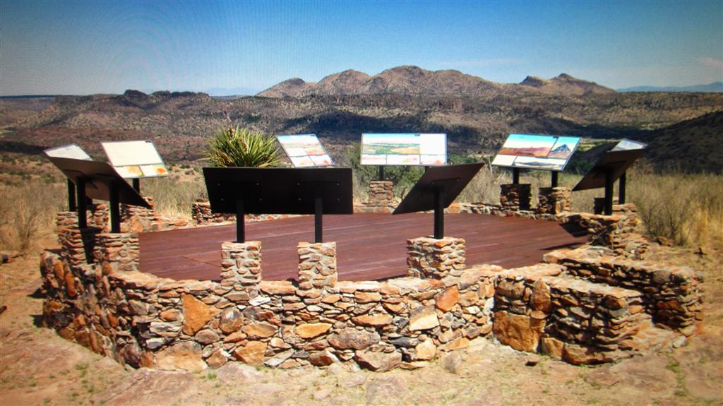
Clayton’s Overlook. Here we found an exhibit that opened in 2009, the exhibit focuses on the geology of the Davis Mountains.
Wrapped along the western side of the nature center building was the Geological Timeline exhibit illustrating a story of oceans and volcanoes with rock samples.
We drove back through Fort Davis and had some lunch at, ah, um, the Stone Village Market? Maybe that's not right, but the food was good and we sat outside to eat it. We drove up highway 17, very scenic, it was about 170 miles back to Midland. That was the 5th day of our trip.
The 6th and last day of our trip we toured Midland, took Sabkha to the dog park, Andrew took us to KD’s Smokehouse for lunch, that place has great food especially if you like meat, and I do like meat! As we were sitting there eating we got a call that our American Airlines flight had been cancelled for the afternoon, (can they just cancel our flight!) it got straightened out and we took a later flight so more time at Andy's house.
The guys messed around with the dirt bikes a bit, we packed up and headed to the airport. Sad to say good bye. What a fun and interesting vacation! Thanks Andy! We had two flights home to Michigan.
We didn't get a chance to hike here, and we had planned to attend a star party at the nearby McDonald Observatory located atop Mount Locke and Mount Fowlkes, but our time was running out in Texas.
We woke to another beautiful sunrise in West Texas.
We had breakfast at the Indian Lodge then packed up once again. We all decided to visit the Chihuahuan Desert Nature Center (their website http://cdri.org/ ) about a 10 mile drive to the southeast.
So it started off to be your typical nature center, the five of us toured the botanical gardens (20 acres) including some 165 species of trees, shrubs, and perennial forbs and a greenhouse containing about 200 species cacti / succulents, interesting but flat with wide gravel paths. A lot of work I'm sure.
Two of our group had to head back to catch their flight out of Midland, so we decided they would leave in the Mazda and we would continue to wander the Chihuahuan Desert Nature Center. We said our good byes and two left for the Midland-Odessa airport.
As we got more into this place I realized it is well supported and dynamic, some nature centers get a little run down and have a lack of interest but that's not how it was at the Chihuahuan Desert Nature Center. At this point we hiked the Modesta Canyon Trail, and the Outside Loop Trail. What a surprise we got on these trails, a canyon here, with water at the bottom, lots of rocks, and a fairly challenging trail. Very nice!
The trail at Modesta Canyon
We climbed up out of the canyon and rounded Lion’s Head.
We walked up to the highest point (how high is it, I don't know) at the Chihuahuan Desert Nature Center,
Clayton’s Overlook. Here we found an exhibit that opened in 2009, the exhibit focuses on the geology of the Davis Mountains.
![]() |
| Our Dynamic Landscape: Geology, Culture, History Exhibit |
Wrapped along the western side of the nature center building was the Geological Timeline exhibit illustrating a story of oceans and volcanoes with rock samples.
We drove back through Fort Davis and had some lunch at, ah, um, the Stone Village Market? Maybe that's not right, but the food was good and we sat outside to eat it. We drove up highway 17, very scenic, it was about 170 miles back to Midland. That was the 5th day of our trip.
The 6th and last day of our trip we toured Midland, took Sabkha to the dog park, Andrew took us to KD’s Smokehouse for lunch, that place has great food especially if you like meat, and I do like meat! As we were sitting there eating we got a call that our American Airlines flight had been cancelled for the afternoon, (can they just cancel our flight!) it got straightened out and we took a later flight so more time at Andy's house.
The guys messed around with the dirt bikes a bit, we packed up and headed to the airport. Sad to say good bye. What a fun and interesting vacation! Thanks Andy! We had two flights home to Michigan.
Langganan:
Postingan (Atom)